This week, I am focused on a potential severe weather threat that may hit the Midwest on Wednesday and Thursday. Please get official information from your local National Weather Service Office in addition to local media.
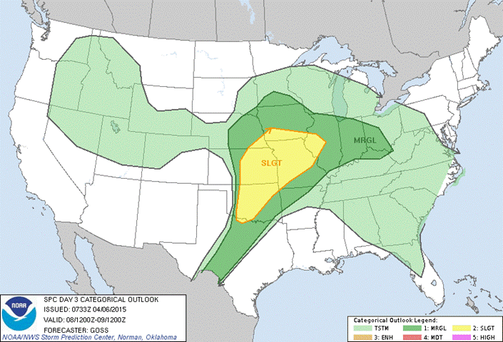
The Storm Prediction Center has issued the above graphic for Day Three—which means today is day one, Tuesday is Day two, and Wednesday is Day Three. Some other models and forecast also mention Thursday as an additional threat. These are storm systems that need to be paid attention to.

Now, with Facebook and Social Media, these Convective Outlook and Categorical Outlooks are readily available from many places on the internet. I recommend that you keep the Official Storm Prediction Center link in your favorites to verify what you may be reading online. When you see the different colors the chart below describe what the colors and categories mean.

The threat this week marks the first large scale threat of the year and is a reminder that severe weather season is upon us all. Take time now to think through where your safe place would be in the event of a tornado. Also, take the time now to check the batteries in your NOAA weather radio or buy some new batteries and a weather radio. I have used the Midland Weather Radio for years in my home and they are available from Lowes, Home Depot, or Amazon.com.
For more information regarding safety in severe weather; please take a moment to review the National Weather Service Severe Weather page.